Flood risk in a changing climate
Flood risks are not restricted to those places labelled as flood zones
Pluvial flooding now accounts for much of the flood risk in many regions. Traditional flood maps do not always capture this threat
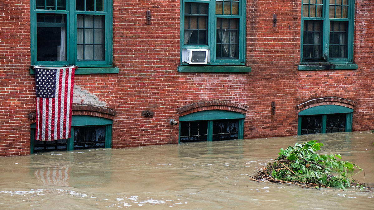
THIS year’s flood events illustrate the accelerating trend of hydrological intensification driven by ongoing global warming. A preliminary global review shows extreme and often record-breaking rainfall on every continent, with many events producing exceptional sub-daily intensities. Crucially, severe flooding is increasingly occurring in locations not historically classified as high risk, prompting renewed scrutiny of exposure and preparedness.
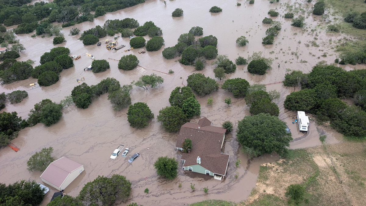
Recent flooding illustrates how once-in-a-lifetime events are now occurring in rapid succession. The Texas Hill Country floods, with more than 500 mm of rainfall in two days, exemplified this shift, resulting in substantial loss of life and revealing gaps in emergency response and insurance coverage. Further evidence of this intensification has been seen in Pakistan, Spain and elsewhere. The persistence and clustering of such extremes align with trends clearly established in 2023 and 2024.
Climate change is increasing rainfall intensity and expanding flood hazard footprints, while societal exposure continues to outpace preparedness.
Flood impacts arise from three principal mechanisms: fluvial flooding, when rivers exceed capacity and inundate surrounding land, coastal flooding, when tides, low-pressure systems and wind-driven surge raise sea levels, and pluvial flooding, when intense rainfall overwhelms drainage capacity.
Pluvial flooding: The hidden driver
While riverine and coastal floods dominate public perception, pluvial floods are a major and growing source of damage. In Britain 6.3m homes are thought to be at risk of flooding from all sources. Of these, 4.6m or 73% are at risk from pluvial flooding. According to the Federal Emergency Management Agency (FEMA) in the US, the proportions at risk from the three main flood mechanisms are very similar. Continental Europe, France, Germany and Poland are dominated by fluvial flood risk, but pluvial flooding is the fastest rising driver.
FEMA produces flood maps, which are used to underpin many risk management activities including administration of the National Flood Insurance Program (NFIP). One of the mapped flood extents is the Special Flood Hazard Area (SFHA) which delineate the 1-in-100-year flood outline. However, all but the most recent versions of these maps do not account for pluvial flooding.
Pluvial flood risk is more difficult to map than fluvial or coastal flooding because it can occur far from rivers or coastlines and requires precise elevation data and knowledge of drainage capacity. The largest uncertainty stems from estimating intense rainfall: long-term rainfall records on which this assessment is based are often limited and climate change makes the problem a moving target. Consequently, many countries have been slow to develop or publish pluvial flood maps, leaving significant gaps in risk assessment and planning.
According to a recent study led by the University of Michigan, pluvial claims typically result in smaller individual payouts than catastrophic river floods (median damage is about $9,500 per claim versus $51,000 for major events) but their sheer frequency makes them costly in aggregate.
In lower risk areas outside SFHAs, pluvial flooding accounts for most claims and casualties. The University of Michigan study reported that 87% of claims from properties outside FEMA’s SFHAs were due to pluvial flooding. Between 1978 and 2021, the NFIP paid $4bn for pluvial flood claims outside of the SFHA, compared to $2.3bn for major river floods in the same zones. These figures exclude uninsured losses, which are likely several times higher.
Action for risk managers
Extreme weather is not just a future concern — it is today’s operational reality. Businesses that fail to adapt will face escalating losses, supply chain disruptions and reputational damage. Here are practical steps to strengthen resilience:
Assess exposure by using government tools like the Environment Agency’s flood risk map or FEMA’s Flood Map Service Center. Do not assume flood risk is zero outside of formal flood zones. Evaluate surface-water risk, especially in urban areas. Consider upstream and downstream dependencies: suppliers, logistics hubs and critical infrastructure.
Where possible, register for flood warnings (river and coastal) and explore local alert systems for surface-water flooding. Develop a comprehensive flood plan that assigns clear responsibilities, identifies vulnerable assets and plans to relocate critical equipment above likely flood levels. Establish communication and evacuation protocols. Test and update plans regularly: treat them with the same rigour as fire safety drills. In England, for properties within the 100-year flood plain, a flood is five times more likely than a home fire.
Prepare for recovery. In the home, this might mean resilient construction but also simple measures like keeping important papers safe and moving key belongings to safety. In business, this might also mean preparation for five key loss types: premises, people, equipment, IT systems and suppliers.
Make sure that insurance coverage is adequate and covers the correct risks including property damage. Be certain that business interruption policies include flooding as a covered peril. Check limits, sub-limits, deductibles and occurrence clauses — flood events often span multiple days, complicating claims.
Looking ahead, climate projections indicate that hydrological extremes will intensify, with convective storms delivering rainfall rates far beyond historical norms even in areas with no historical flood record. A new partnership including Willis and Newcastle University, the Extreme-Futures initiative, will combine advanced climate science and AI to improve forecasting and resilience strategies.
In the interim, businesses cannot afford complacency. Risk managers must recognise that pluvial flooding now accounts for much of the flood risk in many regions — and that traditional flood maps do not always capture this threat.
Neil Gunn is head of flood and water management research at Willis Research Network, and Hayley Fowler is professor of climate change impacts at Newcastle University